Services
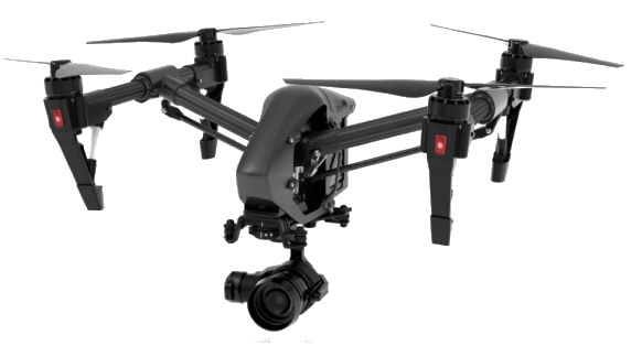
Aerial Videography & Photography
Enhance your project with professional aerial videography and photography services. Whether you require comprehensive documentation of construction progress, want to showcase real estate from a unique perspective, or need safe and efficient roof inspections, our experienced team delivers high-quality results tailored to your needs.
- Construction Progression Monitoring
- Real Estate Showcasing
- Roof Inspections
- Property Documentation
Call or email us to begin planning your next aerial venture.

Media Editing
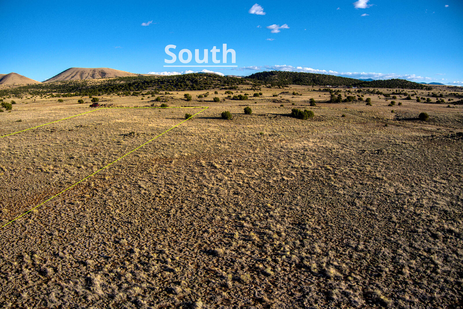
Professional video and photo editing are included with every project, ensuring optimal highlights and balanced color for exceptional visual results. Advanced editing services—such as property boundary overlays on photos or camera tracking in videos—are also available and may require additional time and a revised quote.
Contact us to get your next project started now.
How It Works
Book Your Session
Choose your package and schedule a convenient date. We'll confirm availability and discuss your specific needs and goals for the shoot.
Pre-Flight Planning
We verify location coordinates, check weather conditions, review airspace regulations, and confirm optimal timing for lighting and conditions.
Professional Shoot
Our FAA Part 107 certified pilot captures stunning aerial footage using professional 4K equipment, ensuring comprehensive coverage of your property.
Expert Editing
Professional HDR processing, color correction, and enhancement to showcase your property in the best possible light.
Fast Delivery
Receive your high-resolution photos and videos via secure download link within 24-48 hours (or same-day for rush orders).
Professional Credentials & Service Excellence
Licensed & Insured
Flying Phantoms operates as a fully licensed commercial drone service provider under FAA Part 107 sUAS regulations, ensuring full compliance with federal aviation standards. FAA Part 107 Certified — recurrent training current through May 2028. We maintain comprehensive liability insurance coverage up to $1,000,000 per project, providing our clients with complete peace of mind and professional protection.
Service Coverage
Headquartered in Concho, Arizona, we proudly serve clients throughout the White Mountain region and surrounding communities. Our service area extends up to 50 miles from our base of operations, encompassing Show Low, Snowflake, Holbrook, Heber-Overgaard, and neighboring areas. Extended service coverage is available upon request.
Safety & Quality Standards
Safety is paramount in every operation we conduct. Each flight mission is preceded by a comprehensive pre-flight protocol designed to ensure optimal performance and regulatory compliance:
- Precision UAS compass calibration for accurate navigation and flight stability
- Verification of airspace classifications and restriction zones via current NOTAMs
- Comprehensive equipment inspection and systems testing
- Meteorological assessment including wind speed, visibility, and precipitation conditions
- Geomagnetic field analysis (Kp index) to ensure optimal GPS performance and operational stability
Industry Experience
Our team brings extensive professional experience from the oil and gas exploration industry, where precision data acquisition and adherence to strict operational protocols are essential. This background in high-stakes, technically demanding environments translates directly to the exceptional quality and reliability we deliver in every aerial imaging project. We understand that accurate documentation and professional-grade results are critical to our clients' success.
Our Commitment
At Flying Phantoms, we combine cutting-edge aerial technology with proven industry expertise to deliver exceptional results for real estate professionals, construction managers, property owners, and commercial clients. Every project receives the same meticulous attention to detail and professional standards, regardless of scope or scale.
Gallery
Pricing
Real Estate Photography Packages
| Package | Description | Price |
|---|---|---|
| Basic | 10-15 aerial photos, basic editing, color correction, 2-3 day delivery | $175 |
| StandardMost Popular | 20-25 aerial photos, HDR editing, next-day delivery | $275 |
| Premium | 30+ aerial photos, HDR, twilight shots available, rush delivery (24hr) | $375 |
Aerial Videography Packages
| Package | Description | Price |
|---|---|---|
| Basic | 60-90 second video, 4K footage, basic editing, background music | $225 |
| StandardMost Popular | 2-3 minute video, 4K professional editing, camera tracking, licensed music | $375 |
| Premium | 3-5 minute cinematic video, 4K, advanced effects, multiple locations | $575 |
Combo Packages - Save 15%
| Package | Description | Price |
|---|---|---|
| Real Estate Combo | 15 aerial photos + 90-second video | $340 $400 |
| Premium Listing | 25 aerial photos + 2-minute video | $550 $650 |
Specialized Services
| Service | Description | Price |
|---|---|---|
| Roof Inspection (Residential) | Comprehensive aerial roof assessment with detailed photo report | $200 - $350 |
| Roof Inspection (Commercial) | Large-scale commercial property roof inspection and documentation | $450 - $900 |
| Construction Progress | Per-visit documentation of construction site progress | $250 - $400 |
| Property Documentation | Comprehensive property boundary and terrain documentation | $175 - $400 |
Advanced Editing Add-Ons
| Service | Description | Price |
|---|---|---|
| Property Boundary Overlay | Add property lines and boundaries to aerial photos | +$75 |
| Camera Tracking/Stabilization | Advanced video stabilization and smooth camera movements | +$100 |
| Custom Graphics/Branding | Add your logo, contact info, or custom graphics to media | +$125 |
| Same-Day Rush Delivery | Expedited editing and delivery within 24 hours | +$100 |
✨ Special Offer: First-Time Clients Save 15%
Projects within 50 miles of Concho, AZ include no travel fees. Additional mileage fees apply beyond 50 miles.
All packages include FAA Part 107 licensed pilot and $1,000,000 liability insurance coverage.
Frequently Asked Questions
Are you FAA certified and insured?
Yes! We hold a current FAA Part 107 Remote Pilot Certificate and carry $1,000,000 in liability insurance coverage. All operations comply with FAA regulations and local airspace requirements.
What's your typical turnaround time?
Standard delivery is 24-48 hours after the shoot. We also offer same-day rush delivery for an additional fee of $100. Edited photos and videos are delivered via secure download link.
What happens if weather delays the scheduled shoot?
Safety is our top priority. If weather conditions are unsafe for flight (high winds, rain, poor visibility), we'll reschedule at no additional charge. We monitor weather forecasts closely and will contact you 24 hours before the shoot if conditions look unfavorable.
How far will you travel for a project?
We're based in Concho, AZ and cover projects within 50 miles at no extra charge. For locations beyond 50 miles, we apply a reasonable mileage fee. Contact us for specific pricing for your location.
What file formats do you deliver?
Photos are delivered in high-resolution JPEG format (suitable for print and web). Videos are delivered in MP4 format (1080p or 4K depending on your package). If you need specific formats or RAW files, just let us know!
Can I request specific shots or angles?
Absolutely! We encourage you to share any specific requirements, preferred angles, or features you want highlighted. We'll discuss your vision during the booking process and do our best to capture exactly what you need.
Do you offer discounts for multiple properties or repeat clients?
Yes! We offer a 15% discount for first-time clients, and we provide volume discounts for real estate agents or construction companies booking multiple sessions. Contact us to discuss custom packages for your ongoing needs.
What if I need to reschedule?
We understand plans change. You can reschedule up to 24 hours before your scheduled shoot at no charge. Cancellations with less than 24 hours notice may incur a fee depending on circumstances.
Can you fly in all weather conditions?
Drone operations require safe weather conditions. We cannot fly in rain, high winds (over 20mph), heavy fog, or severe weather. However, we can fly in light cloud cover, and sometimes overcast conditions create excellent lighting for photography!
Do you provide before and after editing comparisons?
All our packages include professional editing (color correction, HDR processing, etc.). If you'd like to see before/after samples or discuss the editing process, we're happy to share examples during your consultation.
Still Have Questions?
We're here to help! Contact us by phone or email and we'll be happy to answer any questions about our drone services.
Call: +1.713.487.8674 | Email: flyingphantoms@gmail.com
Contact Us
Email: flyingphantoms@gmail.com
-Or- Use this form